 r0amwild
The Drive
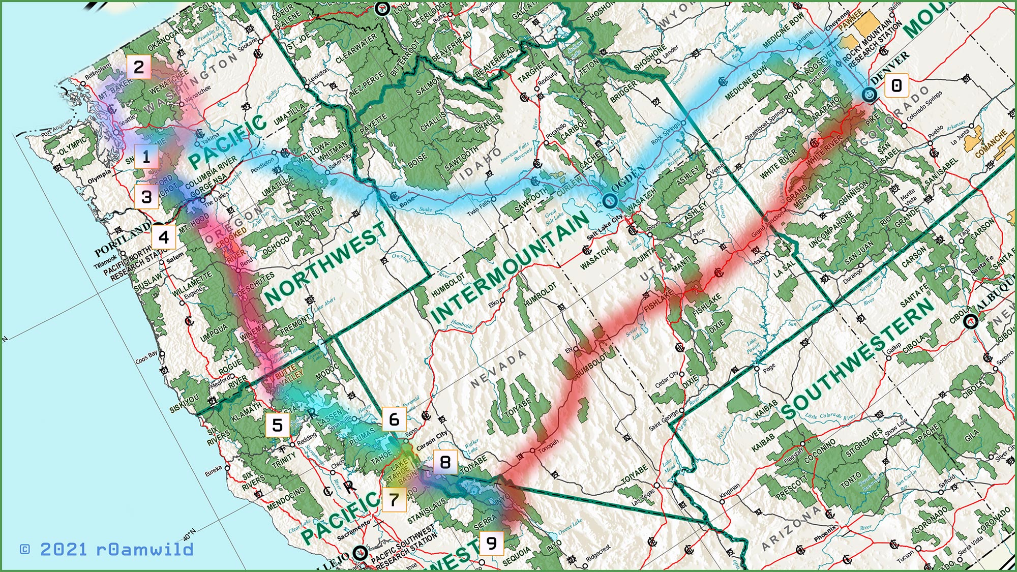
Plans begin to recede behind me like interstate mile-markers as I drive from Denver toward Seattle (demarked box 0 and 1 respectively, light blue line, above). The American West is an enjoyable place to drive. Primarily consisting of wide-open public lands with a smattering of private in-holdings and leased resource extraction operations. This lovely land and all things upon it now pass before me at 65 mph. With my truck purring on cruise-control, FM radio channels come and go with the towns and cities that I pass until finally -- in the late of night -- it is either gospel or nothing. Dark progress on the road is now measured by a regular cadence of gas stops, sodas and snacks. Ultimately, fatigue compels that I find a suitable pull-off and surrender to sleep in my camper.
This had been my first opportunity to explore this northwest region of America and what a privilege I felt it was. Just 150 years ago, the route I drove would have been called the Oregon Trail; now it is known as I-80 as well as other sections of interstate highway. Out of Denver go north to Cheyanne and then hang a left up and over the mountainous continental divide before rolling gently downward past high, dry, grass lands before dipping into the barren salt-caked waste lands that surround the Great Salt Lake of Utah. Moving ever onward, my truck ground gradually back upward into more grasslands before encountering the volcanic badlands which herald the approaching city of Boise and the crossing of the Snake River into Oregon. Up and down a thousand times in rapid succession across rolling foothills and valley rivers before a sustained grade upward into Blue Mountain forests. Elevation gained turns predictably into elevation lost with the pumping of brakes, through tight switchbacks past run-away truck ramps down, down, down to the lower elevations before passing Pendleton Oregon. Progress continues again across gently rolling arid grass lands before passing over the broad, impressive, Columbia River and into southeast Washington State. There, the initial parched sage and grayish rocky badlands yield gradually to fields of grain before continuing upwards to vineyards and then fruit orchards before finally encountering the mountains of which I had seek -- the Cascades.
It is here (point 1, map above), I have the pleasure of established my first camp in a National Forest (NF) campground. The Windy Point campground is not far from Yakama, where I left the interstate behind.
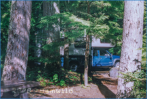 This small campground lies just off highway US-12 which follows along the Tieton River. Once out of my truck, I could immediately sense I was entering a different ecosystem, one that supported huge cedar pine trees. It was wet and cool, almost cold considering it was June and now actually hot in the lowlands which I had just recently crossed. A light drizzle made my camper feel cozy once I had completed my campground permit and paid what cash I had toward the fee. This route (US-12) would take me into the Seattle airport the following day to pick up my climbing partners before making our way further north to Mt. Baker (purple route between point 1 and 2 above).
I recall the rhythmic splatter of condensed mist drip-drops upon my camper roof, complements of the cedar pine branches above my site as I awoke. After brewing coffee and breakfast, I began my way to the Sea-Tac airport. The road gains altitude swiftly, forcing my truck to down-shift into the sustained grade leading up to swelling banks of snow piled high upon the roadside. Coming from the relatively arid Colorado,
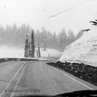 I was surprised by the incredible amount of snow as I made my way over Washington pass. I had planned our expidition for this early June timeframe to ensure any crevasses along our ascent routes would be buried deeply so to ease our way over by way of these early season snow bridges. My thinking at the time was that this would simplify route selection and minimize the risk of anyone punching though and subsequently slowing the ascent. Indeed, it was still snowing at the pass, a wet soggy snowfall which seemed to be preserving snow some ten feet deep along the side of road! Unbeknown to me was the fact that it had been a massive snow year, far above the Washington average and this fact would complicate, rather than aid, our trip. I could only gave a passing admiration of all that snow as I made my way to the airport to pick up my friends at the Sea-Tac airport.